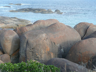


Hyden is in the middle of nowhere – or very close. The rabbit-proof fence is only about 50km to the east of it, which shows you how remote the country is around there. (The rabbit-proof fence – now officially called the State Barrier Fence – is a continuous fence that runs almost due north-south from Esperance to Port Hedland. Its main role is now to keep emus, rather than rabbits, out of the agricultural areas.) Why would we miss Esperance to go to this god-forsaken place? Wave Rock, of course! And we are not the only ones; apparently it is the most visited tourist attraction in WA, with over 100,000 visitors a year! Surely (I thought) it must be over-rated; and after Uluru and King’s Canyon, a disappointment? But no – I confess to a shock of breath-snatching awe when I first looked at it, particularly because you just come around a corner of the path, two minutes’ walk from the caravan park, and suddenly there it is right in front of – and towering over – you. It is just beautiful; a graceful sweeping curve accentuated by the vertical stripes through it. Sadly, it also has an ugly concrete wall running along the top, which we thought initially was to stop the tourists falling off (bureaucracy definitely gone mad) but in fact was built by early settlers in the area, in order to collect run-off from the rock as a reliable water supply. Funny how attitudes and priorities change. We would consider this a scandalous desecration of an amazing natural phenomenon now!
The tourist brochures try to convince you that it takes two days to fully appreciate all the aspects and elements of the rock, but even they have to throw in a game of golf to get through the second afternoon. We found that we had plenty of time before lunch to do a lovely long walk along the base of the rock and through some of the surrounding countryside, and still fit in a visit to the unlikely combination of a wildlife park, “lace museum” and “toy soldier collection” all within 200m of the rock and the caravan park. Then we set off on the road to Kalgoorlie, via “Mulka’s cave” – another feature of the same rock formation about 16km up the road, where Aboriginal legend has it that Mulka, the unfortunate progeny of star-crossed lovers, who was cursed with crossed eyes so he couldn’t hunt effectively, lived on small children until he was hunted and killed by his tribe. Our children’s lives were vaguely threatened by the presence of a large brown snake (the first one I’ve seen outside of a wildlife park since I’ve been in Australia) but we escaped unscathed.
After a night in another roadside camp with too much traffic noise and awful toilets but a nice campfire and a bit more space than the average caravan park, we headed into Kalgoorlie. Here the caravan park was surprisingly pleasant, and the receptionist much more helpful than most. There was a great playground and even some shade (although no grass). We booked ourselves onto the Superpit tour for the next day, did a load of washing and some shopping, and even fitted in a visit to “Ye Olde Lolly Shoppe” – where they sold lots of sweets I remember buying in the UK in the 1970s. Needless to say, the girls were in heaven for at least an hour afterwards!
In the morning we thought we’d have plenty of time to “do” the Mining Hall of Fame before our tour at 1pm, but it turned out to be like Whale World, with a huge range of displays, information and activities, and we ended up having to rush off without doing it justice. Still, we did have an underground tour and insight into how mining used to be before it was turned into “open cut” mining (a lot like opal mining, actually); we also saw some gold being melted and poured into an ingot (about $100,000 worth in one bar the size of a couple of Toblerones), and we climbed up into one of the enormous dump trucks that are used in the mine, which are 10m tall, carry over 200 tonnes of rubble in one load, and have four massive tyres on them, each worth around $30,000 new. And by the way – the amount of gold in one truck-load is likely to be about the size of a golf-ball, and only about one in six truckloads has any gold in it at all. Yet they still turn out about $5 million a day of gold!
On the Superpit tour we sat in a bus again – like at Port Hedland – except that we were allowed to get out at a viewing spot and look down into the great hole, which is about half a kilometre deep and apparently visible from space. And it is going to be about twice the current size before they’ve finished with it. (What will they do with it then, I wonder……..?) It was very impressive, especially when you could see those massive dump trucks toiling up and down the roadways, looking like tiny toy trucks below us.
Despite fervent pleas, we did not return to the lolly shop, but ended our stay in Kalgoorlie with a leisurely “all-you-can-eat” dinner where Tahlia made my day (no – my year) by choosing a fresh pear for dessert!
And that was it for our inland detour. On Friday it was time to start the dreaded crossing of the Nullarbor Plain.
Captions for pictures- The classic Wave Rock picture. Someone won a competition with a picture like this in 1962, which was published on the cover of National Geographic and that's how everyone found out about the Rock and started visiting it.
- The other classic (corny) shot of surfing the rock. It is actually harder than it looks: it is very difficult to stand up there without slipping down.
- Kirralee's friend Benson at the caravan park
- Kendall about to eat a witchetty grub we found in some firewood at the bush camp site (yeah sure she is!)
- Can we call this a maths exercise?
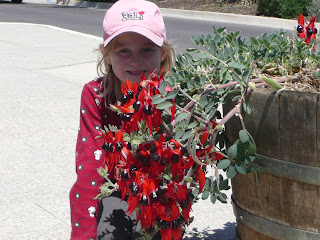
- An unexpected lovely flower in Kalgoorlie
- A crucible heated to 1000 degrees C in order to melt the gold. There is a thin yellow line in front of the crucible, which is the melted gold pouring into the ingot mould- The super Cat dump truck (this one has been retired and repainted for display purposes)
- The working Cats looking like toys in the Superpit


